The Bargos Islands
Posted: Sun May 22, 2016 8:49 pm
I was looking into the Bargos Islands. On Mercator's map on the top right island it reads:
I only found something about the Bargu campestria (plain of Bargu; that's where the name probably originated from) in N. T. Mirov's "Notes On The Domestication Of Reindeer" (pdf, read from "Marco Polo" at p.11) but nothing about the islands farther north.
But at least I found some high resolution ocean floor maps showing Greenland underneath its ice sheet:
(all thumbnails lead to the original source)


From left to right:
WORLD OCEAN FLOOR -- John B. Garver Jr., John Shupe (1981, National Geographic Society) [.sid, 47mb]
THE FLOOR OF THE OCEANS -- Bruce C. Heezen, Marie Tharp (1976, American Geographical Society) [.sid, 16mb]
ARCTIC OCEAN FLOOR -- Heinrich Caesar Berann (1971, National Geographic Society) [.jp2, 17mb]
ARCTIC OCEAN -- Heinrich Caesar Berann (1971, National Geographic Society) [.jp2, 17mb]
In order to view .sid and .jp2 files you can use ERDAS ER Viewer 2014 v14.01 (29 MB)
The official download website requires registration but here is a direct download link from the Spanish Instituto Tecnológico Agrario.
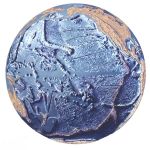
Here is the OCEAN FLOOR AROUND ANTARCTICA (ca. 1972) and the ocean floor globes (1979) all done by H. C. Berann:
(I couldn't find them in high resolution)


----------Antarctica------------Atlantic Hemisphere-------Pacific Hemisphere--------Pacific Hemisphere 2
Now back to the Bargos Islands:
The left thumbnail below leads to the familiar Mercator map WITH a search function.


The right one is a map from Matthias Quad from his atlas Geographisch Handtbuch which he published with Bussemacher in 1600. The map is right between the pages 77 and 77a which have written a German text on them titled Nordt Polus.
I can barely read the old German text and the "Fraktur font" doesn't make it any easier... Before I start giving myself a headache with this, I wanted to ask daniel if he is familiar with these two pages and perhaps has already seen an english translation somewhere. Would definitely save me some time.
btw I found out about Matthias Quad's map after seeing this 1997 lecture (58min) by Harry Hubbard and Paul Schaffranke. They also showed the oldest map of atlantis as well as two old hollow earth illustrations.


Question regarding the (upsidedown) atlantis map: Is that what later came to be the Bargos Islands?
daniel, in your paper there is a vignette picturing the four islands (the one where you wrote the names of the islands). Where did you find this vignette?
Has anybody found something useful in M. Paulus Ven: lib.1, cap.61 in this regard? Because I did not.In the northern parts of Bargu there are islands, so says Marco Polo, the Venetian, Bk.1, chap.61, which are so far to the north that the Arctic pole appears to them to deviate to the southward. (wiki)
I only found something about the Bargu campestria (plain of Bargu; that's where the name probably originated from) in N. T. Mirov's "Notes On The Domestication Of Reindeer" (pdf, read from "Marco Polo" at p.11) but nothing about the islands farther north.
But at least I found some high resolution ocean floor maps showing Greenland underneath its ice sheet:
(all thumbnails lead to the original source)


From left to right:
WORLD OCEAN FLOOR -- John B. Garver Jr., John Shupe (1981, National Geographic Society) [.sid, 47mb]
THE FLOOR OF THE OCEANS -- Bruce C. Heezen, Marie Tharp (1976, American Geographical Society) [.sid, 16mb]
ARCTIC OCEAN FLOOR -- Heinrich Caesar Berann (1971, National Geographic Society) [.jp2, 17mb]
ARCTIC OCEAN -- Heinrich Caesar Berann (1971, National Geographic Society) [.jp2, 17mb]
In order to view .sid and .jp2 files you can use ERDAS ER Viewer 2014 v14.01 (29 MB)
The official download website requires registration but here is a direct download link from the Spanish Instituto Tecnológico Agrario.
Here is the OCEAN FLOOR AROUND ANTARCTICA (ca. 1972) and the ocean floor globes (1979) all done by H. C. Berann:
(I couldn't find them in high resolution)


----------Antarctica------------Atlantic Hemisphere-------Pacific Hemisphere--------Pacific Hemisphere 2
The collaboration with the national Geographic Society also lead to maps of the ocean floors starting in 1966. In co-operation with the pioneer of oceanography Prof. Bruce Heezen of the Columbia University, NY, and his assistant Mary Tharp maps of all the ocean floors were created. This co-operation culminated in the famous World Ocean Floor map done in 1977 for the Columbia University and the U.S. Navy. (http://www.berann.com/panorama/index.html)
Now back to the Bargos Islands:
The left thumbnail below leads to the familiar Mercator map WITH a search function.


The right one is a map from Matthias Quad from his atlas Geographisch Handtbuch which he published with Bussemacher in 1600. The map is right between the pages 77 and 77a which have written a German text on them titled Nordt Polus.
I can barely read the old German text and the "Fraktur font" doesn't make it any easier... Before I start giving myself a headache with this, I wanted to ask daniel if he is familiar with these two pages and perhaps has already seen an english translation somewhere. Would definitely save me some time.
btw I found out about Matthias Quad's map after seeing this 1997 lecture (58min) by Harry Hubbard and Paul Schaffranke. They also showed the oldest map of atlantis as well as two old hollow earth illustrations.


Question regarding the (upsidedown) atlantis map: Is that what later came to be the Bargos Islands?
daniel, in your paper there is a vignette picturing the four islands (the one where you wrote the names of the islands). Where did you find this vignette?


